


1-5 Sweet Lips Voting District, Chester County, Tennessee
About
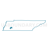
Outline

Summary
| Unique Area Identifier | 668109 |
| Name | 1-5 Sweet Lips Voting District |
| County | Chester County |
| State | Tennessee |
| Area (square miles) | 30.40 |
| Land Area (square miles) | 30.38 |
| Water Area (square miles) | 0.02 |
| % of Land Area | 99.95 |
| % of Water Area | 0.05 |
| Latitude of the Internal Point | 35.40845770 |
| Longtitude of the Internal Point | -88.54921270 |
Maps


Graphs
Select a template below for downloading or customizing gragh for 1-5 Sweet Lips Voting District, Chester County, Tennessee


Neighbors
Neighoring Voting District (by Name) Neighboring Voting District on the Map
- 1 Finger Voting District, McNairy County, TN
- 1-2 Enville Voting District, Chester County, TN
- 1-6 Harmony Voting District, Chester County, TN
- 2-1 Jacks Creek Voting District, Chester County, TN
- 2-4 Mifflin Voting District, Chester County, TN
- 3 Leapwood Voting District, McNairy County, TN
- 5 East Chester School Voting District, Chester County, TN
- 6 Henderson City Hall Voting District, Chester County, TN
Top 10 Neighboring County Subdivision (by Population) Neighboring County Subdivision on the Map
- District 1, McNairy County, TN (3,885)
- District 3, McNairy County, TN (3,807)
- District 5, Chester County, TN (3,262)
- District 2, Chester County, TN (3,213)
- District 1, Chester County, TN (2,765)
- District 6, Chester County, TN (2,552)
Top 10 Neighboring Unified School District (by Population) Neighboring Unified School District on the Map
Top 10 Neighboring State Legislative District Lower Chamber (by Population) Neighboring State Legislative District Lower Chamber on the Map
Top 10 Neighboring State Legislative District Upper Chamber (by Population) Neighboring State Legislative District Upper Chamber on the Map
Top 10 Neighboring 111th Congressional District (by Population) Neighboring 111th Congressional District on the Map
Top 10 Neighboring Census Tract (by Population) Neighboring Census Tract on the Map
- Census Tract 9701, Chester County, TN (5,870)
- Census Tract 9703, Chester County, TN (5,779)
- Census Tract 9702, Chester County, TN (5,482)
- Census Tract 9301, McNairy County, TN (4,218)
- Census Tract 9302, McNairy County, TN (2,202)